You’ve hit your search limit
Start your free trial to keep exploring full traffic and performance insights.
Get StartedAnalyse de l'application Dronetag pour le 12 avril
Dronetag
- Dronetag
- Google Play Store
- Gratuit
- Outils
With Dronetag, all drones fly safe & compliant. Our app helps everyone to receive and read drone identification data and offers a wide range of professional features to owners of Dronetag remote identification devices. We create a world where all drones can access airspace without the need to worry about accidents.
Dronetag Mini and Dronetag Beacon are add-on devices for remote identification designed and manufactured by us. They can be attached to any drone, making it digitally visible via Remote ID standards to all air traffic participants.
- Dronetag Mini -
Weighs 32 grams, offers up to 14-hour battery life, and supports both Direct & Network Remote ID technologies (DRI & NRI) via Bluetooth and LTE.
- Dronetag Beacon -
Weighs only 16 grams, offers up to 16-hour battery life, and supports Direct Remote ID technology (DRI only) via Bluetooth broadcasting.
Connect your device to the Dronetag app and enjoy the following features:
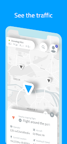
- Airspace scanner displaying all participants with Remote ID (available even without Dronetag device)
- Remote identification for your drone compliant with EU & US regulations
- Option to add and manage an unlimited number of unmanned aircraft
- Map of restricted zones such as airports within the whole EU & US
- Flight planning, including the time and altitude
- Flight tracker with a real-time position on the map and notifications
- Journal feature to save and export flight data of all your drones
- Full-text search: locations, restricted zones, aircraft, and Dronetag devices
Connect with the Dronetag team
Let’s chat about drones, flying, and tech. Send us your feedback or questions to: support@dronetag.cz
Rang d'utilisation de Dronetag
Le classement d'utilisation est basé sur l'algorithme de Similarweb qui calcule les installations actuelles et les utilisateurs actifs sur une période de 28 jours.
Toutes les catégories dans
États-Unis--
Outils dans
États-Unis--
Intérêts des utilisateurs & catégories principales
Principales catégories et applications utilisées par les utilisateurs de Dronetag
Top des catégories
Affinité
Top des applications pour cette catégorie
24%
20%
17%
10%
Principaux concurrents & apps alternatives
Applications ayant une forte probabilité d'être utilisées par les mêmes utilisateurs, à partir du même store.
ABAX Admin
Owner.com
BaseMap: Hunting Maps and GPS
Spoked: AI Cycling Coach
avril 12, 2026