- Home
- Free App Analytics
- iMarées
iMarées app analytics for December 9
iMarées
- Briac Hardouin
- Apple App Store
- Free
- Weather
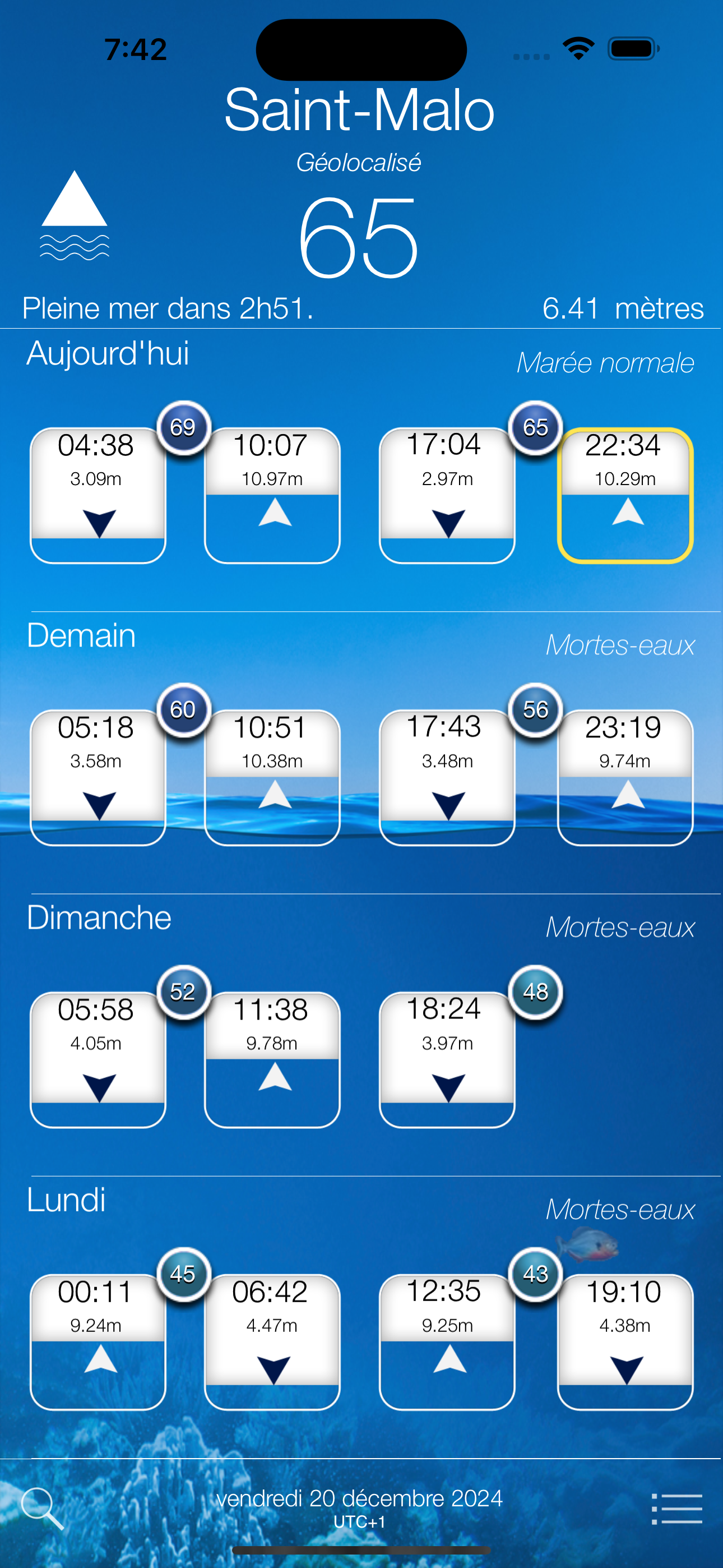
iMarées est une application de prédiction de marée complète et très simple d'utilisation !
L'application donne les horaires, coefficients et hauteurs d'eau dans plus de 130 ports du littoral français et sait retrouver les horaires de référence pour plus de 1000 villes côtières.
Compagnon indispensable de vos vacances en bord de mer, iMarées vous suivra dans vos sorties en bateau, pêche à pied et autres excursions sur la grève.
Fonctionnalités:
- L'application fonctionne en totale autonomie, aucune connexion Internet n'est nécessaire. Pratique lorsqu'on est en mer.
- Grâce à la recherche par coefficient, vous ne raterez pas une grande marée et planifierez facilement vos pêches à pied ou interventions sur un bateau.
- Vous pouvez également ajouter facilement des rappels dans le calendrier de votre iPhone pour les marées de fort coefficient.
- Les horaires sont données automatiquement pour le port le plus proche par géolocalisation, mais vous pouvez ajouter des ports favoris depuis la page de configuration.
- Le fond d'écran représente le niveau actuel de la marée.
Dans sa version gratuite, iMarées permet la consultation des horaires, hauteurs d'eau et coefficients pour les deux prochains jours. L'accès aux calendriers n'est pas disponible dans la version gratuite.
En achetant un pack d'horaires, vous pourrez accéder d'un coup d'oeil aux prédictions pour les 7 prochains jours et consulter le calendrier des marées pour l'année en cours et toute l'année civile pour laquelle vous avez souscrit le pack, ainsi que le calendrier des coefficients pour l'année. Ainsi par exemple, le pack d'horaires 2026 permet d'accéder à toutes les informations sans restrictions jusqu'au 31 décembre 2026. Les données de l'application sont mises à jour annuellement.
Mise en garde:
Les horaires fournies par l'application peuvent diverger des horaires officiels calculés par le SHOM, de quelques minutes ou quelques centimètres pour les hauteur d'eau.
(la précision est d'une quinzaine de minutes pour les horaires, d'une dizaine de centimètres pour le niveau d'eau et d'environ 5% pour les coefficients). L'application ne peut en aucun cas se substituer aux horaires officiels requis pour la navigation. L'auteur se dégage de toute responsabilité quant aux dommages liés à l'utilisation et/ou l'interprétation des données fournies par cette application.
Un pack d'horaires expire à la fin de la période indiquée, un nouveau pack devant être acheté pour l'année suivante. A l'expiration d'un pack d'horaire, l'application reste utilisable dans sa version limitée.
Si vous rencontrez des difficultés en utilisant cette application, si vous ne trouvez pas le port que vous cherchez ou que vous constatez des écarts trop importants dans les prédictions, n'hésitez pas à nous en faire part sur notre page facebook. Nous nous efforcerons de répondre rapidement à vos questions et d'apporter des correctifs à l'application si nécessaire.

Store Rank
The Store Rank is based on multiple parameters set by Google and Apple.
All Categories in
United States--
Weather in
United States--
Create an account to see avg.monthly downloadsContact us
iMarées Ranking Stats Over Time
Similarweb's Usage Rank & Apple App Store Rank for iMarées
Rank
No Data Available
iMarées Ranking by Country
Counties in which iMarées has the highest ranking in its main categories
No Data to Display
Top Competitors & Alternative Apps
Apps with a high probability of being used by the same users, from the same store.
marée.info Essentiel
EURL BOLO Informatique
Tide Flow : Tides Times, Waves
ManoMaya
Beaches and weather
Christophe Denoual
Marées
Christian Guine
December 9, 2025