


7月12日 的 Ryotei - GPS Tracker 應用程式分析

Ryotei - GPS Tracker
- Thor Mikashima
- Apple App Store
- 付費
- 導航
Ryotei is a GPS travel log app that records your routes and lets you relive them with maps, photos, speed data, and elevation information.
Whether you're touring on a motorcycle, driving, or exploring new places on a trip, Ryotei helps you keep a detailed record of where you've been and how you got there.
Replay your routes on a map, view color-coded tracks based on speed or elevation, and browse photos taken along the way directly from the map.
"Where did I ride that day?"
"Which roads did I take?"
"Where was that photo taken?"
Save your journeys with routes, photos, and detailed travel data, then revisit them anytime.
■ Main Features
【GPS Route Recording】
• Record your routes using GPS
• Start, pause, resume, and stop recording
• Background recording support
• Automatically resumes recording after an unexpected interruption
• Store distance, speed, elevation, heading, and location accuracy
• Multiple location tracking modes for different activities
【Route Replay】
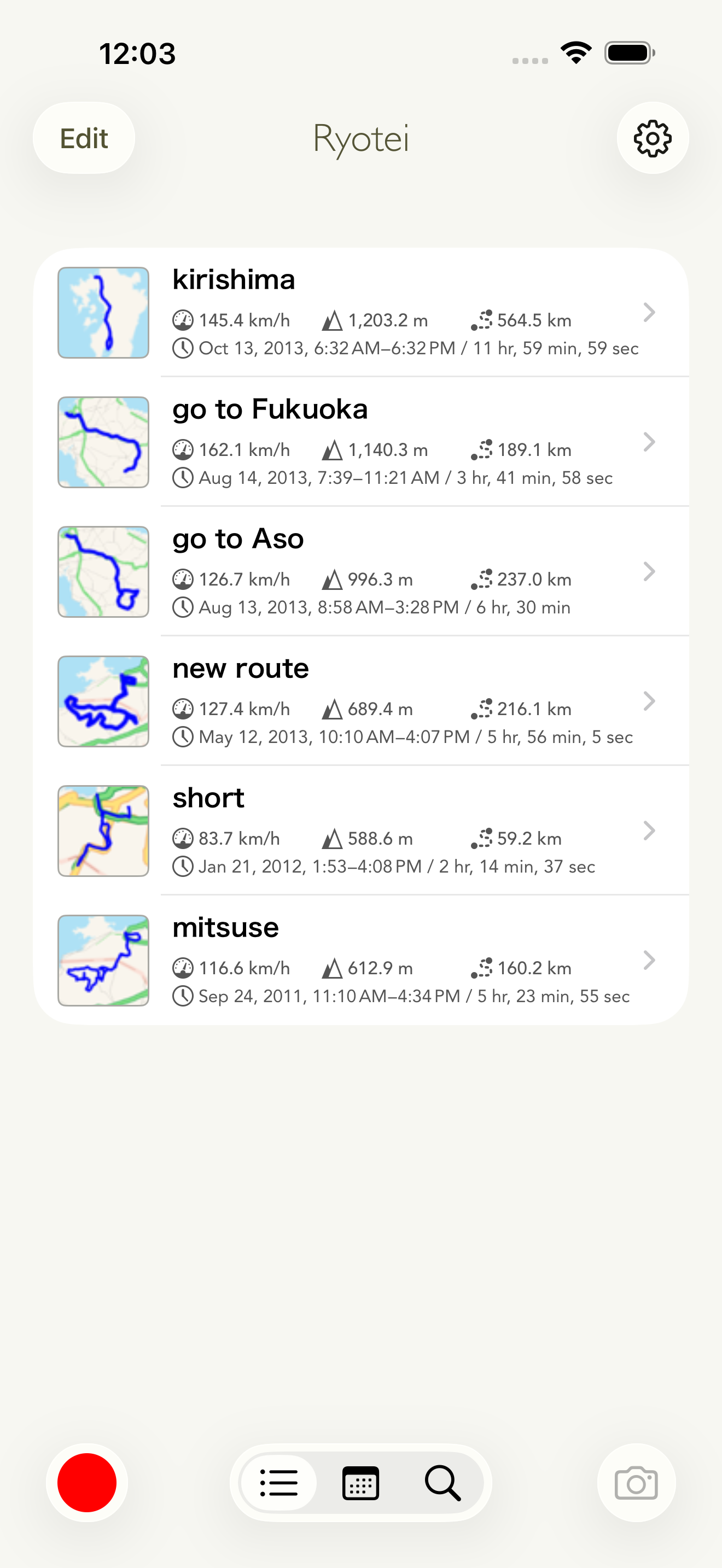
• Replay recorded routes on the map
• Relive your journey while reviewing speed and elevation changes
• Easily revisit traffic delays, rest stops, and memorable sections of your trip
【Speed & Elevation Color Mapping】
• Display routes with colors based on speed or elevation
• Quickly identify changes in speed and altitude along your route
• Ideal for reviewing motorcycle tours and scenic winding roads
【Graph View】
• Display speed and elevation data as graphs
• Analyze changes over time
• Synchronize map playback with graph data
【Route Comparison】
• Overlay another route on the map
• Compare different trips and routes
【Photo Features】
• Capture photos using the built-in camera while recording
• Display photo locations directly on the map
• Browse photos taken during your trip
• View shooting date, location, heading, and elevation information
• Share photos easily
【Map Features】
• Standard, Satellite, and Hybrid maps
• Add and edit pins and waypoints
• Support for map rotation and tilt
【Record Management】
• List and calendar views
• Search by title, distance, maximum speed, or maximum elevation
• Organize records with customizable color tags
【File Integration】
• Export routes in KMZ, GPX, and CSV formats
• Import route files from external sources
• Generate KMZ files including photos
【Siri Shortcuts】
• Start recording
• Pause recording
• Resume recording
• Stop recording
• Take photos
■ Recommended For
• Motorcycle touring enthusiasts
• Drivers who want to keep travel records
• Travelers who want to revisit places they've been
• Riders who want to analyze winding roads and scenic routes
• Users who want to review speed and elevation changes
• Anyone who wants to manage routes and photos together
• Users who need GPX and KMZ export support
More than just route recording.
Ryotei helps you preserve and relive your motorcycle tours, drives, and journeys through maps, photos, and travel data.
商店排名
商店排名基於Google和Apple設定的多個參數。
所有類別 在
美國--
導航 在
美國--


 Ryotei - GPS Tracker VS.
 7月 12, 2026