You’ve hit your search limit
Start your free trial to keep exploring full traffic and performance insights.
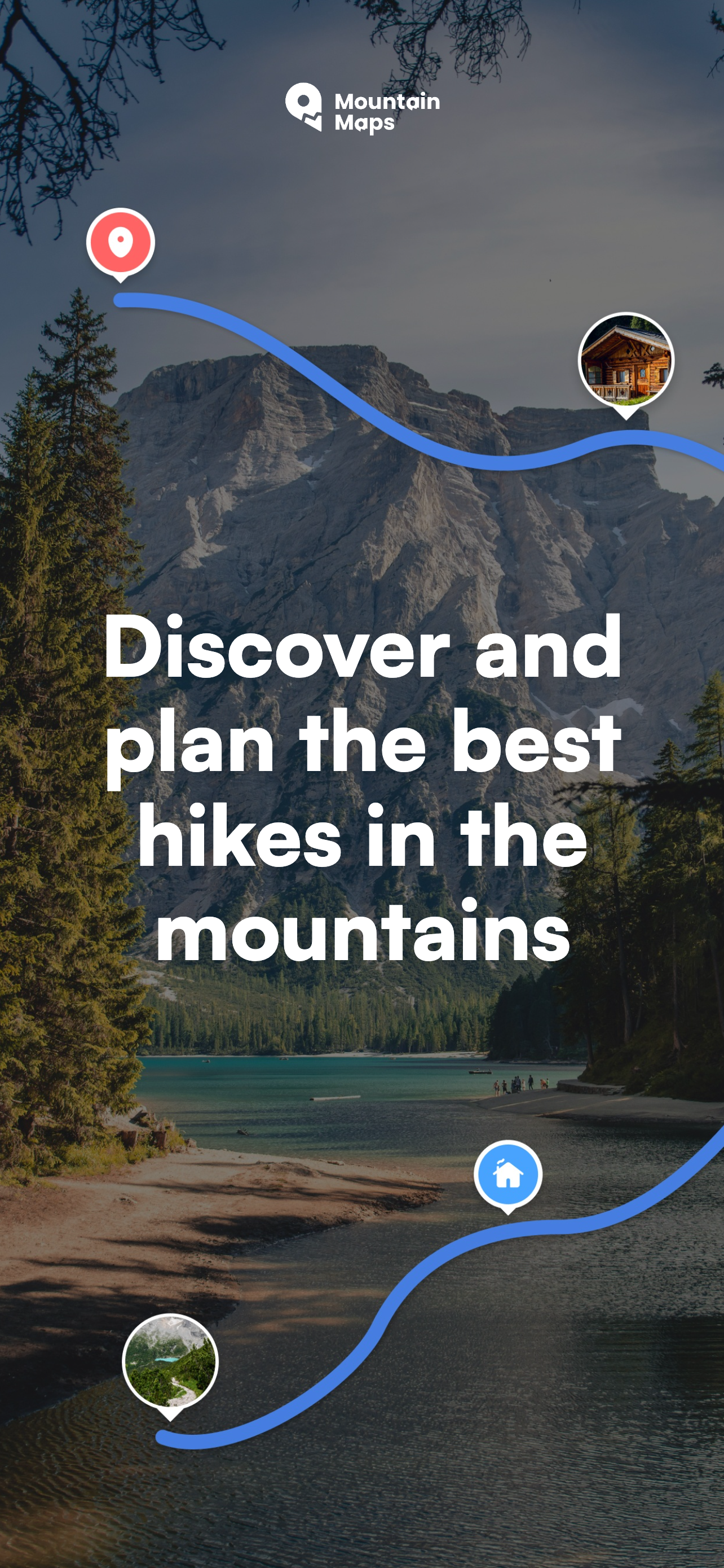
Get StartedMountain Maps: Hiking analisi dell'app per 4 aprile
Mountain Maps: Hiking
- MountainMaps SRL
- App Store di Apple
- Gratis
- Navigazione
WHAT CAN I DO WITH MOUNTAIN MAPS
———
Can I plan a hiking route from point A to point B?
Yes. You can create a complete itinerary with:
• Route calculation powered by artificial intelligence
• Intermediate waypoints
• “Avoid via ferrata” filter
• Detailed analysis of elevation gain, snow and terrain type
• Elevation profile with slopes and surface details
Perfect for trekking, mountain hiking and long-distance walks.
———
Can I find new hikes suitable for my level?
Yes. With Mountain Maps, you’re not limited to routes created by other users: Artificial Intelligence generates a personalized itinerary based on your needs. The AI analyzes:
• Starting point
• Desired distance
• Points of interest
• Loop routes
And creates a tailor-made route for you in just a few seconds.
———
Can I organize a route on ski slopes?
Of course. Mountain Maps allows you to:
• View ski resort maps and lifts
• Plan from point A to B directly on the slopes
• Activate the “Avoid black slopes” filter
• Check slope gradients and snow conditions
Ideal for alpine skiing and snowboarding.
———
Does the app work without internet?
Yes, completely. You can:
• Download offline maps of all Europe
• Navigate without data coverage
• Use GPS even in remote areas
Perfect for mountain environments where there is no signal.
———
GPS NAVIGATOR FOR THE MOUNTAINS
Turn your smartphone into a professional hiking navigator:
• Real-time GPS position
• Navigation along your planned route
• Save routes and favorite points
• Full offline support
———
DETAILED TOPOGRAPHIC MAPS OF ALL EUROPE
Access advanced cartography with:
• Contour lines
• 3D terrain view
• Slope layer
• Snow depth layer
• Free offline maps
All integrated into one single app for trekking and skiing.
———
COMPLETE ROUTE ANALYSIS
Before you leave, you’ll always know what to expect. Each itinerary includes:
• Detailed elevation profile
• Average and maximum slope
• Terrain type
• Snow condition indication
• Elevation gain analysis
Ideal to evaluate route difficulty and safety.
———
GPX FILE SUPPORT
Do you have a GPX track? With Mountain Maps you can:
• Import GPX files
• Export routes
• Sync with GPS devices such as Garmin
• Perfect integration with your outdoor equipment.
———
FREQUENTLY ASKED QUESTIONS
Is Mountain Maps only suitable for summer hiking?
No. It is designed for all seasons, thanks to specific information about snow presence along the route.
Can I avoid sections that are too difficult?
Yes. You can filter via ferrata or black slopes and analyze gradients and elevation before starting.
Is it useful for beginners?
Yes. Clear data on slope, snow and terrain helps you choose routes suited to your level.
Can I use it as an alternative to classic hiking apps?
Yes. Mountain Maps combines planning, GPS navigation, technical analysis and offline maps in a single solution.
———
Download Mountain Maps now and turn every mountain adventure into a safer, more informed and complete experience.
Terms of Use: https://www.apple.com/legal/internet-services/itunes/dev/stdeula/
This app uses background location even when the app is not open to allow the user to use navigation.
Classifica degli store
La classifica del store si basa su diversi parametri stabiliti da Google e Apple.
Tutte le categorie in
Stati Uniti--
Navigazione in
Stati Uniti--
Principali concorrenti e app alternative
App con un'alta probabilità di essere utilizzate dagli stessi utenti, provenienti dallo stesso store.
MowiSnow
WHIP LIVE Moto, Bike, Trekking
Outdoor Trentino
Terra Map - Trail Explorer
aprile 4, 2026