

You’ve hit your search limit
Start your free trial to keep exploring full traffic and performance insights.
Get StartedAnalyse de l'application SatFish Fishing App pour le 24 mai

SatFish Fishing App
- Bloodydecks LLC
- App Store Apple
- Gratuit
- Sports
Find the Offshore Bite Faster, Now More Powerful Than Ever
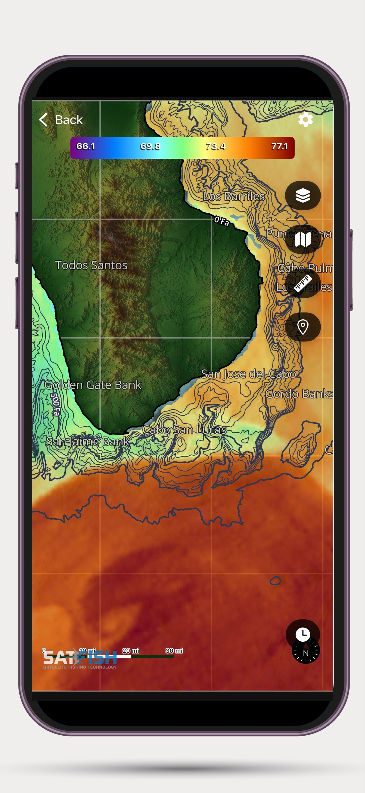
SatFish Offshore Fishing App puts advanced offshore fishing intelligence right at your fingertips. With high-definition satellite imagery, customizable SST and chlorophyll layers, and enhanced offline reliability, you’ll spend less time searching and more time fishing.
Whether you're planning at the dock or running 100 miles offshore, SatFish helps you locate temperature breaks, clean water edges, and productive zones with precision.
What’s New in This Major Update
- Improved Offline Caching – More reliable maps offshore, even when you're out of signal range.
- Add Your Own Waypoints – Mark your own hot spots, structure, and areas you want to target, even while you're out fishing
- Adjustable SST & Chlorophyll Ranges – Dial in subtle temperature breaks and color changes to fine-tune your search.
- Distance & Heading Tool – Instantly measure range and heading between any two points.
- Depth - New Depth-at-Cursor Data and Labeled Bathymetry Contours.
- Loran-C Overlay (U.S. East Coast) – Responsive, easy-to-read TDs.
- Smoother Zoom & Rotation – Faster, more responsive map performance.
- Modernized Navigation Interface – Cleaner menus and improved usability.
- Expanded Coverage - Now covering major offshore fishing hot spots in Mexico and Central America
Core Features
- High-Resolution SST Charts – Spot temperature breaks to zero in on pelagic bite zones.
- Cloud-Free SST & Multi-Day Composites - Full coverage even when skies are cloudy.
- Chlorophyll & Water Clarity Layers – Find clean, productive water that holds fish.
- Detailed Bathymetry - Visualize offshore seamounts, pinnacles, and dropoffs that gather bait and gamefish.
- 5-Day Wind Forecasts – Plan around wind and sea conditions with precision.
- GPS Tracking on Downloaded Maps – Follow your live position even with no cell signal.
- Offline Access – Automatically saves recently viewed maps for use offshore.
- Integrated Trip Planning Tools – Map out location and distance to the bite zone, draw routes, and plan smarter.
- Covers All U.S. Offshore Regions – From the Gulf of Maine to the Pacific Coast and Hawaii.
Why Smart Anglers Choose SatFish
Stop burning fuel in lifeless water. SatFish combines the latest satellite mapping technology and decades of offshore fishing experience to guide you directly to the most productive offshore fishing grounds - fast. Built by fishermen, for fishermen.
Requirements:
- Active SatFish.com subscription
- WiFi or cellular connection to retrieve charts
- GPS-enabled device for real-time location tracking
Fish smarter. Run shorter. Read the water and stay on the bite with SatFish.
Classement dans le store
Le classement des stores est basé sur plusieurs paramètres définis par Google et Apple.
Toutes les catégories dans
États-Unis--
Sports dans
États-Unis--
Principaux concurrents & apps alternatives
Applications ayant une forte probabilité d'être utilisées par les mêmes utilisateurs, à partir du même store.

RipCharts

CR MAP by Canyon Runner

The Reel Time App | Fish On

Salty Offshore
 SatFish Fishing App VS.
 mai 24, 2026