You’ve hit your search limit
Start your free trial to keep exploring full traffic and performance insights.
Get Started- Home
- Free App Analytics
- Distance and Area Measure
Distance and Area Measure app analytics for January 17
Distance and Area Measure
- Kevin Willett
- Apple App Store
- Paid
- Productivity
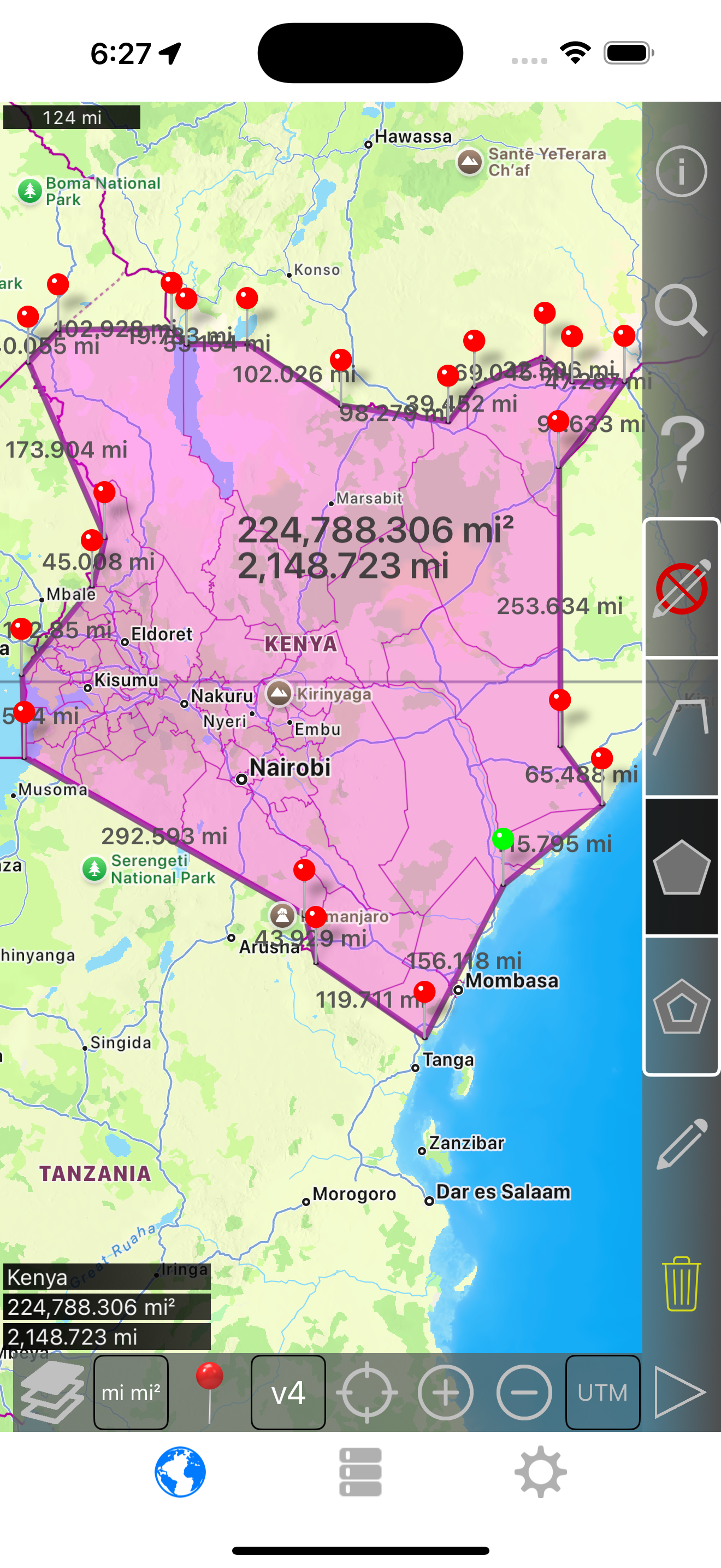
Measure land, roads, parks, countries, lakes, etc from a satellite view. Calculates distances, areas, and perimeters.
Features that this application offers that most competitors do not:
- Add custom distance and area units.
- Draw interior polygons. For example, land area with bodies of water removed.
- Add a point to the middle of a path (Most only allow you to add to the end of the path) Tap to add to the end of a path. Long press to add to the middle of a path.
- Swap two points in a path or polygon.
- Add your current location from GPS receiver.
Features:
- 3 map layer options
- Export and import .kml files via Dropbox, iCloud, email, etc
- Pins are draggable and manually editable
- Name, notes, and color fields for each path and polygon
- Email or text message path and polygon data
- 4 verbosity modes. See only the information that you want to see
- Search by postal code, city, address, etc
- Get addresses near point on map
4 drawing modes:
- Path
- Polygon
- Polygon with hollow spaces inside
- No edit mode (to prevent accidental edits)
Values displayed for paths:
- Total distance
- Incremental distance for each waypoint
Values displayed for polygons:
- Area
- Perimeter
- Distance for each side
Add points to a path or polygon in 1 of 4 ways:
- Tap on the map
- Use current location
- Enter coordinates manually
- Import .kml file
Default distance units include:
- Meter
- Foot
- Yard
- Kilometer
- Mile
- Nautical mile
Default area units include:
- Square meter
- Square foot
- Square yard
- Square kilometer
- Square mile
- Square nautical mile
- Square acre
- Square hectare
Coordinate formats:
- Degrees
- Degrees, minutes
- Degrees, minutes, seconds
- UTM / UPS (Universal Transverse Mercator) / (Universal Polar Stereographic)
- MGRS (Military Grid Reference System)

Store Rank
The Store Rank is based on multiple parameters set by Google and Apple.
All Categories in
United States--
Productivity in
United States--
Create an account to see avg.monthly downloadsContact us
Distance and Area Measure Ranking Stats Over Time
Similarweb's Usage Rank & Apple App Store Rank for Distance and Area Measure
Store Rank
Rank
Distance and Area Measure Ranking by Country
Counties in which Distance and Area Measure has the highest ranking in its main categories
Top Competitors & Alternative Apps
Apps with a high probability of being used by the same users, from the same store.
Land Mgmt.
S-Parts Inc.
CatchYaBreath
Savvy7 GmbH
Area - Distance
Corvallis Microtechnology, Inc.
matchedRF
DirectRF LLC
January 17, 2026