Outdoor Navigation ape@map app analytics for March 14
Outdoor Navigation ape@map
- Onyx Technologie OG
- Apple App Store
- Free
- Navigation
Outdoor and Hiking Navigation
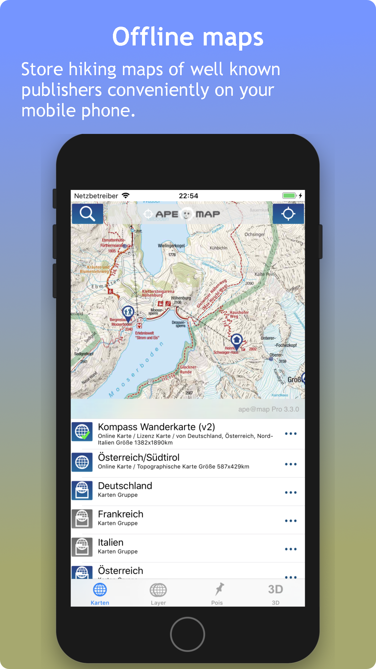
ape@map 3D Outdoor-Navigation for hiking-maps, offline capable.
GPS navigation with more than 70,000 tours and help call (with SMS), PC planning software for maps of leading card manufacturers and interfaces to DVDs:
- Compass Maps (Switzerland, Austria, Canary Islands, Balearic Islands, Bavaria, Lake Garda, South Tyrol, ...), AMAP Austria,
- TOP 50 Germany,
- SwissMap,
- DAV & PES
- TouratechQV (Worldwide)
- Free OSM - Maps.
- First and real SRTM 3D display alongside Google Earth.
More than 70,000 tours (biking, hiking, skiing) from our partners gps tour.info, alpintouren.at and geo-coaching.net with reviews / height model / text / images COMPASS TOP50 maps and cards. The map coverage of the tour services currently affects South Tyrol, Austria and Germany and is constantly expanding.
ape@map works even without mobile network.
Please contact support@apemap.com for further questions or error reports.
Only then will we have a chance to help.
(Note: We are a certified company of VeriSign, more at https://lic.apemap.at)
Store Rank
The Store Rank is based on multiple parameters set by Google and Apple.
All Categories in
United States--
Navigation in
United States--
Top Competitors & Alternative Apps
Apps with a high probability of being used by the same users, from the same store.
alpenvereinaktiv
Relief Maps: Hike, Ski, Climb
Topo GPS - Topographic maps
Outdooractive
March 14, 2025