onX Offroad: Trail Maps & GPS app analytics for March 22
onX Offroad: Trail Maps & GPS
- onXmaps
- Google Play Store
- Free
- Maps & Navigation
Navigate off-road and find the trails you’re looking for with onX Offroad. 3D trail maps, GPS mapping, and compass navigation — discover what’s open nearby or explore something new with ease.
Filter trails by accessibility for 4x4, SxS, dirt bikes, moto, ATV/Quads, Overland, and snowmobiles. Access 650K+ miles of off-road trails nationwide, spread across 852M acres of public land. View property lines, private landowner information, and acreage right in the app.
Stay connected off the grid! onX Offroad’s new Cell Coverage Layers show up-to-date coverage for AT&T, Verizon, and T-Mobile. Whether you’re off-roading, camping, or working remotely, know where you’ll have service for emergencies and plan your adventure with confidence.
Get directions from the tarmac to the trails with turn-by-turn navigation and sync onX Offroad with Android Auto. Save Offline Maps to your phone or tablet. Find trailheads, trailer parking, non-ethanol fuel stations, campgrounds, and more.
Adventure starts where the pavement ends. Go where other maps can’t with onX Offroad.
onX Offroad Features:
▶ OHV Trails & Map Layers
• Find trails for your activity – SxS, 4x4, ATV, dirt bikes, snowmobiles & more
• Switch from Dirt to Snow Mode for data on groom reports & avalanche forecasts
• Toggle map layers for info on weather, land boundaries & cell service
• Identify cell coverage areas for AT&T, Verizon & T-Mobile
▶ Offline Navigation & Route Builder
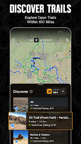
• View open and close dates, difficulty ratings & trail photos
• Save Offline Maps without losing interactive land and trail data
• Get off-road turn-by-turn directions with voice commands & sync with Android Auto
• Map routes that automatically snap to roads and trails
▶ Trip Tracker & Recreation Points
• Track distance, location, speed or elevation. Save & share trips with friends
• GPS navigation & versatile map imagery – 3d, topo, satellite or hybrid
• Add Waypoints to mark campsites, fuel stations, fishing access & more
• Customize maps by marking recreation points, rock crawls or obstacles
▶ Private Property Maps (Elite Only)
• Access private land ownership information across the nation
• View public land, boundaries & acreage by tapping anywhere on the map
• Identify National Forest, BLM, National Park land and more
Download onX Offroad and experience a trusted planning, mapping, and navigation app that always gets you home safely.
▶ Free Trial
Start an Elite trial for free when you install the app. Experience the difference of a premiere off-roading tool for seven days.
▶ Premium & Elite Offroad Memberships:
Enjoy our Premium features for $34.99/year. With Elite, access all of our Premium features plus property maps, land owner info, and industry brand discounts for $99.99/year.
• 650K+ miles of motorized roads and off-road trails
• Trails for 4x4, Side-by-Side, dirtbikes, dual sport, ATV, Quads, Overlanding & snowmobiling
• 852M acres of public land across the U.S.
• 24K topographic maps and 3D maps for the entire U.S.
• Designated camping areas, campsites, campgrounds, hot springs, breweries & more
• Save unlimited Offline Maps for navigation without cell service
▶ Government Information & Data Sources
onXmaps, Inc. does not represent any government or political entity, though you may find various links to public information within our services. For more information on any government information found within the services, click on the associated .gov link.
• https://data.fs.usda.gov/geodata/
• https://gbp-blm-egis.hub.arcgis.com/
• https://www.arcgis.com/home/group.html?id=00f2977287f74c79aad558708e3b6649#overview
▶ TERMS OF USE: https://www.onxmaps.com/tou
▶ Privacy Policy: https://www.onxmaps.com/privacy-policy
▶ FEEDBACK: If you have any trouble or have an idea of what you’d like to see in the app next, please contact us at support@onxmaps.com. We’d love to hear from you.
onX Offroad: Trail Maps & GPS Usage Rank
The usage rank is based on Similarweb's algorithm that calculates current installs and active users over a 28-day period.
All Categories in
United States#6,092
Maps & Navigation in
United States#65
Users Interests & Top Categories
Top categories and apps used by onX Offroad: Trail Maps & GPS users
Top categories
Affinity
Top apps within the category
More apps
15%
12%
8%
6%
Top Competitors & Alternative Apps
Apps with a high probability of being used by the same users, from the same store.
Gaia GPS: Offroad Hiking Maps
BaseMap: Hunting Maps and GPS
HuntStand: GPS Maps & Tools
FarOut
March 22, 2025