- Home
- Free App Analytics
- Aircraft Altimeter
Aircraft Altimeter app analytics for March 20
Aircraft Altimeter
- Sean Flanagan
- Apple App Store
- Paid
- Navigation
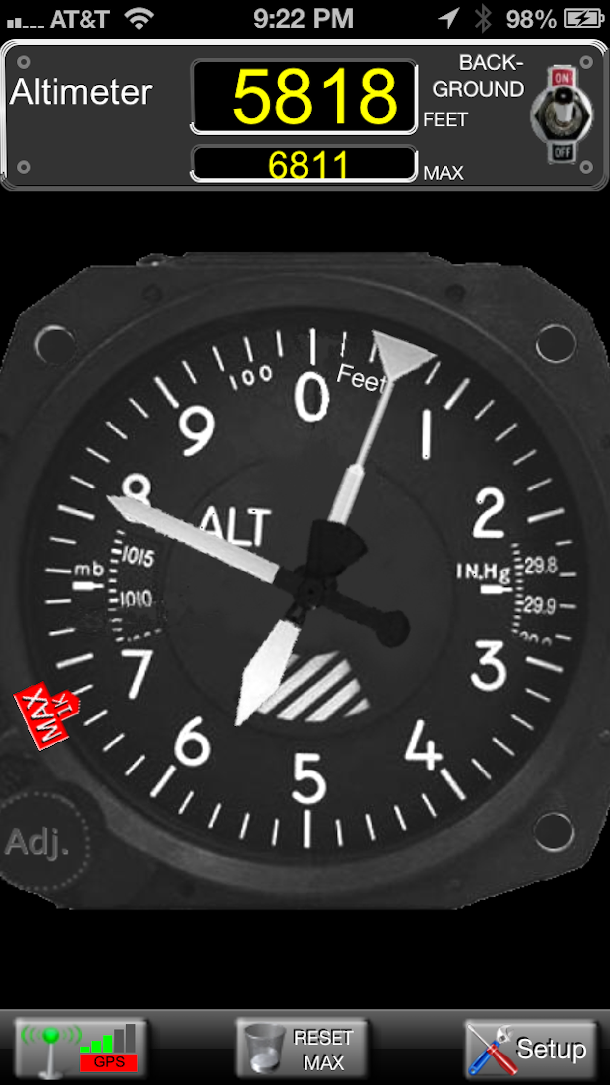
This photorealistic altimeter simulates the analog altimeter commonly found in general aviation airplanes. The meter movement is smooth and realistic.
See your current altitude in both analog and digital displays simultaneously. Both displays can be configured independently to show either Meters or Feet.
The altimeter can be adjusted, similar to an actual unit, by touching the "Adj." knob on the analog display.
Also includes a pop-up display showing all information coming from the iPhone GPS, including latitude, longitude, speed, heading, and horizontal/vertical uncertainty.
The altitude information comes from your device's internal Barometer or GPS, which is somewhat limited. If you use the barometer, there will be variations due to atmospheric conditions. If you use the GPS technology, it will only work outdoors, with a clear view of the sky. The altitude reading may be hundreds or even thousands off and may take a minute or two for the GPS to lock on to the satellites. This program is intended for entertainment and/or educational purposes only.
This program will only work on a device which has a GPS. Barometer mode requires a device with a barometric pressure sensor.
Continued use of GPS running in the background can dramatically decrease battery life.

Store Rank
The Store Rank is based on multiple parameters set by Google and Apple.
All Categories in
United States--
Navigation in
United States--
Create an account to see avg.monthly downloadsContact us
Aircraft Altimeter Ranking Stats Over Time
Similarweb's Usage Rank & Apple App Store Rank for Aircraft Altimeter
Store Rank
Rank
Aircraft Altimeter Ranking by Country
Counties in which Aircraft Altimeter has the highest ranking in its main categories
No Data to Display
Top Competitors & Alternative Apps
Apps with a high probability of being used by the same users, from the same store.
Glider Polar Coefficients
Robert Walker
Max Peak
Piet Jonas
Scenic Map Western Canada
Mark Granger
Flight Instruments
Candidus LLC
March 20, 2025