- Home
- Free App Analytics
- SITA eWAS for iPhone
SITA eWAS for iPhone app analytics for January 3
SITA eWAS for iPhone
- SITA EWAS APPLICATION SERVICES S.L.
- Apple App Store
- Free
- Weather
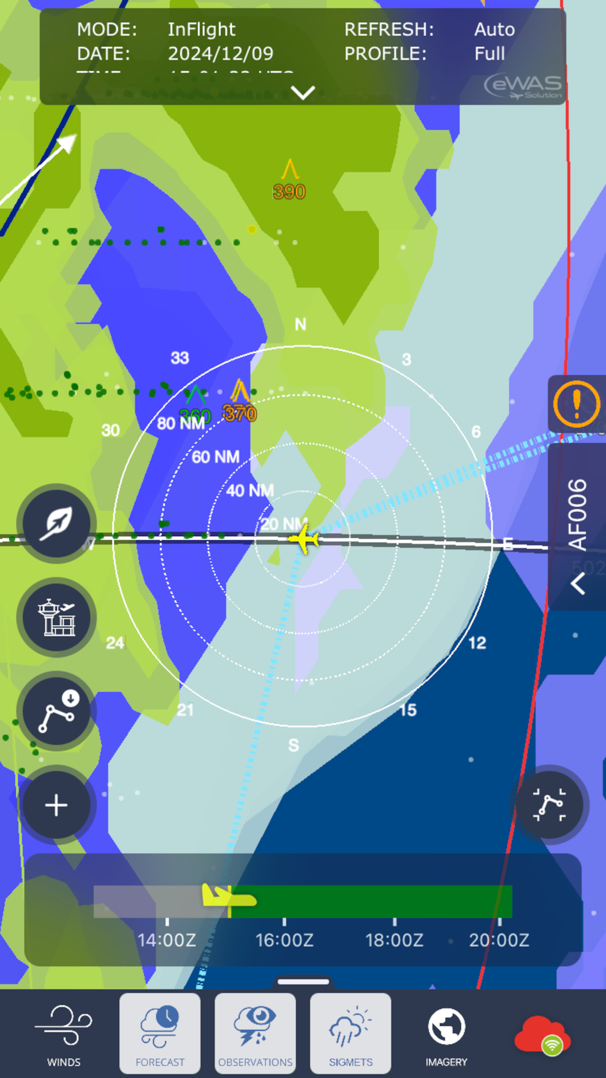
Weather Awareness Service for your Electronic Flight Bag
eWAS provides airline pilots a complete weather situation for their flights. The application presents the last observations and forecasts in an innovative horizontal and vertical view providing a clear 4D view with the time. eWAS data can be used at ground for a better flight preparation and even onboard the aircraft to receive continuous updates during the flight. Thanks to specific integration onboard the aircraft, data can be received by satellite and even by ACARS communication. New data format and compression allow eWAS to uplink forecast with a very limited bandwidth to limit the communication costs. ATC flight plan can be directly requested to the eWAS ground servers or copy paste from the flight folder.
eWAS offers the following weather data:
· Thunderstorm forecast and nowcast
· Clear air turbulence
· Icing
· Volcanic Ash
· Lightning
· SIGMET
· Pireps
· Wind
· Tropopause
· METAR / TAF
· And more data on request.
Highly customizable, the application allows to define an airline policy with various options including the selections of various weather providers. Specific connection to the Airline OCC can also be requested to get for example flight plans and airports.

Store Rank
The Store Rank is based on multiple parameters set by Google and Apple.
All Categories in
United States--
Weather in
United States--
Create an account to see avg.monthly downloadsContact us
SITA eWAS for iPhone Ranking Stats Over Time
Similarweb's Usage Rank & Apple App Store Rank for SITA eWAS for iPhone
Rank
No Data Available
SITA eWAS for iPhone Ranking by Country
Counties in which SITA eWAS for iPhone has the highest ranking in its main categories
No Data to Display
Top Competitors & Alternative Apps
Apps with a high probability of being used by the same users, from the same store.
Constant WX Brief
David Lederman
ADLConnect
Sebastian Golze
Aviation Weather Route Planner
Flygo-Aviation Ltd
RocketRoute FlightPlan
Aircraft Performance Group, LLC
January 3, 2025