- Home
- Free App Analytics
- UAV Forecast
UAV Forecast app analytics for March 21
UAV Forecast
- Matthew LLOYD
- Apple App Store
- Free
- Weather
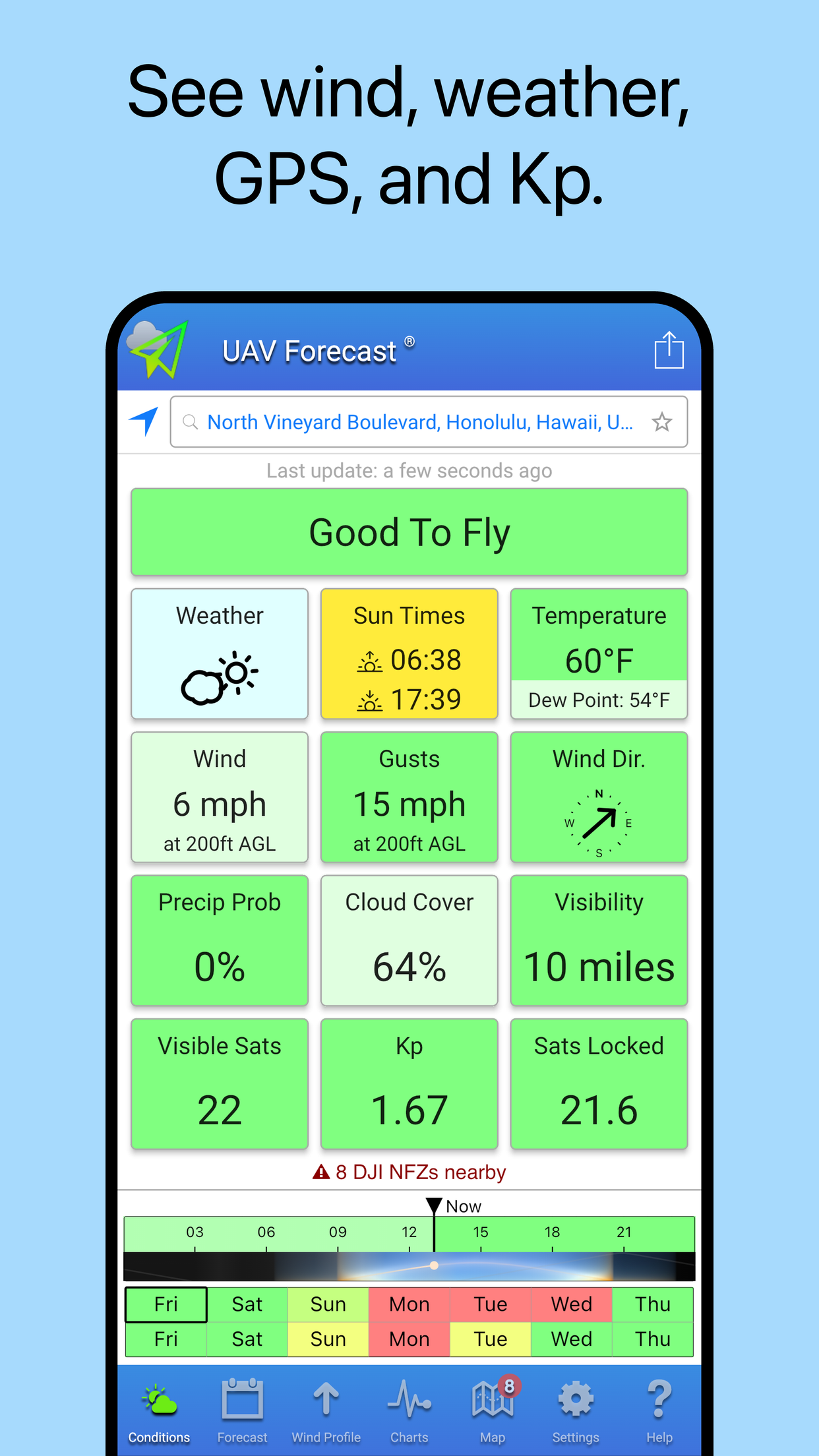
When will it be good to fly your quadcopter? See the weather forecast, GPS satellites, solar activity (Kp), No-Fly Zones and flight restrictions, all in one convenient tool. Perfect for DJI Neo, Mini, Mavic, Air, Inspire, FPV, and Hover, Autel and Skydio drones, and many other Unmanned Aerial Vehicles and Systems.
UAV Forecast is the original, best, and classic tool for drone pilots. Suitable for both beginners and advanced pilots, recreational and commercial, features include:
• Hyperlocal weather data, including detailed wind and gust speeds at ground level and at any altitude.
• GPS satellite data including Galileo and GLONASS, solar weather (Kp) index, and more.
• Hourly forecasts up to 15 days.
• Automatic color-coded analysis of the conditions: green for Good To Fly, red for Not Good To Fly.
• Fully configurable thresholds.
• Light and Dark themes, with automatic switching at sunrise and sunset.
• Location search and Favorite Locations.
• Full tablet support.
Our users include paraglider and paramotor pilots too.
Become a subscriber for 24-hour, 7-day, or 15-day hourly forecast and many other features. Payment will be charged to iTunes Account at confirmation of purchase. Subscription automatically renews unless auto-renew is turned off at least 24-hours before the end of the current period. Account will be charged for renewal within 24-hours prior to the end of the current period at the same price you originally paid. Subscriptions may be managed by the user and auto-renewal may be turned off by going to the user's Account Settings after purchase.
Terms: https://www.uavforecast.com/terms

Store Rank
The Store Rank is based on multiple parameters set by Google and Apple.
All Categories in
United States--
Weather in
United States#186
Create an account to see avg.monthly downloadsContact us
UAV Forecast Ranking Stats Over Time
Similarweb's Usage Rank & Apple App Store Rank for UAV Forecast
Store Rank
Rank
UAV Forecast Ranking by Country
Counties in which UAV Forecast has the highest ranking in its main categories
No Data to Display
Top Competitors & Alternative Apps
Apps with a high probability of being used by the same users, from the same store.
Drone Forecast. UAV Air map
Aleksandr Alekseev
AeroWeather Lite
Lakehorn AG
Wind Compass
Maple Media Apps, LLC
Dronecast - Weather for Drones
Pinverse LTD
March 21, 2025