3月18日的Yorkshire Three Peaks应用程序分析
Yorkshire Three Peaks
- Yorkshire Dales National Park Authority
- Apple 应用商店
- 付费
- 旅游
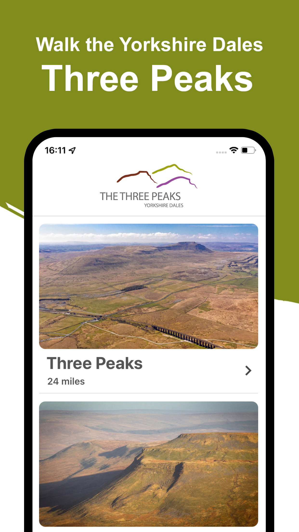
The Three Peaks of Pen-y-ghent, Ingleborough and Whernside are among the best-known in the Yorkshire Dales National Park. Every year thousands come to reach the top of at least one or to conquer all three in one go.
The app contains route details for the classic 24-mile circular walk, route maps for the individual peaks, Whernside, Pen-y-ghent and Ingleborough and four other shorter walks in the Three Peaks area. Don’t just come for the day, come for the stay and explore more of this spectacular area and its scenery.
This GPS enabled app provides reassurance as you follow the arrow along your chosen route. It will also show you how far you are around the route.
This app has been developed alongside our National Park Yorkshire Three Peaks Rangers who have added points of interest along the routes for you.
The app also includes important safety advice and the code of conduct, which will help you stay safe on the walks and help protect our local communities.
The app is not a mapping tool. You must take other forms of navigation with you and know how to use them. We recommend you have an OS Explorer OL2 Yorkshire Dales (Southern and Western) map with you.
Using GPS tracking uses more of your battery than normal – do not rely solely on this app when walking.
Always be prepared, conditions can change rapidly in an upland area such as the Three Peaks.
You must read the safety information contained in this app before using the route information.
The Yorkshire Three Peaks are very fragile environments, and the public rights of way network is under pressure from the hundreds of thousands of visitors that come to enjoy it each year. Maintaining the paths in the Yorkshire Three Peaks area costs on average £35 per metre.
The proceeds of this app all go towards helping the Yorkshire Dales National Park with this work.
Contains OS data © Crown copyright and database right 2020.
Contains OpenStreetMap Data © OpenStreetMap contributors.
https://www.openstreetmap.org/copyright
This walking app was developed for the Yorkshire Dales National Park Authority by the team at Local Walks - www.localwalks.co.uk
App terms and conditions:
https://www.yorkshiredales.org.uk/apptermsandconditions
商店排名
商店排名基于 Google 和 Apple 设置的多个参数。
所有品类在
美国--
旅游在
美国--
三月 18, 2025