KOMPASS Outdoor & Hiking Maps аналитика приложений для 19 марта
KOMPASS Outdoor & Hiking Maps
- KOMPASS-Karten GmbH
- Google Play Store
- Бесплатный
- Здоровье & Фитнес
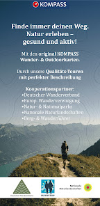
Where the paved roads end, KOMPASS's world begins. Our outdoor and hiking map app is the perfect companion for your hikes, mountain tours, cycling or MTB adventures and other outdoor activities.
Navigate with professional maps featuring marked trail networks, signs, landscape names, summits, as well as nature reserves, highlights and huts both on and off the beaten path.
Choose from thousands of editorially reviewed and certified hiking and biking tours, described by experienced authors. As a PRO member, gain access to everything you need for relaxed hikes with family and friends or adventures in undiscovered areas away from the crowds.
Features & Content:
Tour Recording & Planning
Genuine KOMPASS Hiking and Outdoor Maps
OFFLINE Storage of Maps and Tours
Satellite Map with Additional Information and Points of Interest
Slope Overlay (Alps)
GPS-Location, Live-Tracking
Import of GPX Data
KOMPASS Certified Hiking and Biking Tours with descriptions
Tour Filtering (Difficulty, Distance, Mountain hut…), Tour Types, Elevation Profiles
Digital Hiking and Biking Guides for Various Holiday Destinations
On www.kompass.de/outdoorkarte/, PRO members have access to additional maps (public transportation, topography, Switzerland), advanced tour planning, and a clear and fast tour search. Saved tours are automatically synchronized with the app.
FREE TRIAL PERIOD OF THE PRO SUBSCRIPTION:
The app with basic features (base map, location, tour recording) is free (KOMPASS Basic). With a KOMPASS PRO membership, you have access to all features and content. After registering, we offer you a trial period for PRO (activatable on www.kompass.de in your profile settings). The subscription ends automatically.
THE GENUINE HIKING MAPS & OUTDOOR MAPS:
Our maps strike the ideal balance between content density and clarity. Not every hiking trail is a via ferrata, and not every mountain hut is accessible by a mountain bike trail. Paths, trails, and climbs, rest stops, viewpoints, landmarks, etc., are clearly marked or labeled. As a PRO member, you can easily read this information and more from the map materials of over 500 KOMPASS hiking maps.
THEMATICALLY MARKED TRAIL NETWORKS:
Hiking and biking trails, bike parks, trails, via ferrata, ski tours, cross-country ski tracks
Quality hiking trails: certified by the German Hiking Association
Long-distance hiking trails: E-paths, Camino de Santiago, Via Romea, …
Long-distance cycling trails: Weser Cycle Path, Elbe Cycle Path, EuroVelo, …
Conduct and Disclaimer:
All trails and tours are researched to the best of our knowledge and are intended as suggestions. Use them at your own risk. The actual condition and usability of trails and terrain can change temporarily or permanently due to natural events, landowners, and structural changes. Data updates occur after research. Always adhere to any prohibitions, signs, and markings on-site. Current local inquiries are necessary. KOMPASS-Karten GmbH cannot assume liability under any circumstances.
About KOMPASS-Karten GmbH:
Since 1953, KOMPASS has stood for reliable quality. We are the world's largest producer of high-quality hiking, biking, and ski tour maps. In our versatile range, every outdoor enthusiast can find the right product: from northern Germany through Austria to Italy, Istria, Mallorca, and the Canary Islands.
www.kompass.de/produkte/produktfinder/
Further Information and Notes:
Continuous use of GPS can significantly reduce battery life.
In the App Store, you can manage subscriptions, cancel them, and disable automatic renewal after purchase.
For questions or comments, contact: support@kompass.at
Privacy Policy: www.kompass.de/service/datenschutz/
Terms of Use: www.kompass.de/kompass-pro-allgemeine-geschaefts-und-nutzungsbedingungen/
Рейтинг использования KOMPASS Outdoor & Hiking Maps
Рейтинг использования основан на алгоритме Similarweb, который подсчитывает текущие установки и активных пользователей за 28-дневный период.
Все категории в
Соединенные Штаты--
Здоровье & Фитнес в
Соединенные Штаты--
Лучшие конкуренты & Альтернативные приложения
Приложения с высокой вероятностью будут использоваться одними и теми же пользователями, из одного и того же магазина.
My Emotional Compass
GPX Viewer
Orca: Boat GPS, Charts, Routes
Whympr : Mountain and Outdoor
март 19, 2025