Análisis de la app Orca: Boat GPS, Charts, Routes para 17 de marzo
Orca: Boat GPS, Charts, Routes
- Orca Technologies AS
- Google Play Store
- Gratis
- Mapas y navegación
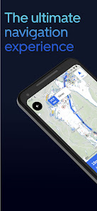
Orca - The Ultimate Boating App
* Crisp online and offline nautical charts
* Modern chart design to maximize legibility.
* Satellite hybrid maps to ease your approaches
* Tailored routes for sailboats and powerboats
* Most comprehensive AIS data feed
* Global marine weather forecast with temperature, wind, tides and currents
* Add the Orca Core 2 to get boat integration - instruments, autopilot, remote control and radar integration
Works across all platforms - on your phone, tablet, and Orca Display 2.
Orca is the next-generation boating system that runs on your mobile and tablet, and on your boat. Experience the award-winning boating app for free.
CAPTIVATING MARINE CHARTS
Orca's next-generation charts are crisp, easy to read, and respond instantly. High-resolution satellite marine charts make harbor entries and anchoring easier than ever.
Orca combines the best of paper chart design with a cutting-edge chart engine. Far ahead of anything else you've tried, Orca gives you the most responsive and beautiful charts on the market. No matter how fast you zoom, pan and rotate, the Orca charts will keep up and show you what you need.
Our satellite hybrid charts blend high-resolution satellite imagery with marine chart data to give you an even better understanding of harbor approaches and challenging navigation maneuvers.
INCREDIBLE ROUTEFINDING
Set your destination, and Orca will find the way instantly. Routes are tailored for your boat and Orca learns from you and other boaters, so you can navigate like a local no matter where you are.
A true generation-leap, the Orca Routing Engine analyzes millions of data points in the blink of an eye to give you great, tailor-made routes to your destination.
GLOBAL AIS
Orca integrates MarineTraffic AIS feed to provide you with the most comprehensive AIS solution in a navigation app. Over 400 000 boats are tracked in real-time with extended information such as Images.
FLEXIBLE INSTRUMENTS
Get instruments for your phone, tablet and Orca Display. Connect to thousands of devices, from transducers to wind sensors and AIS receivers. Tailor instruments just the way you like them – with perfect legibility day and night.
CONNECTIVITY THAT MATTERS
While Orca is fully capable offline, it truly shines online. Seamlessly sync routes and spots between your devices. View hyper-local weather forecasts with down-to-the-minute forecasts for your exact location. Get notifications before rainfall or other bad weather while underway.
Orca is also clever. It monitors your upcoming trips and notifies you if the forecast changes for the worse so you can prepare and make changes if needed.
ONE STEP AHEAD OF BAD WEATHER
Weather is the difference between a perfect and a stressful day at sea. It is why weather forecasts are deeply ingrained in the Orca experience. Down-to-the-minute marine weather forecasts help you plan your trips and find the best departure time. While you are underway, the Orca keeps an eye on the weather and sends you real-time alerts if forecasts change.
YOU ARE IN GOOD COMPANY
Orca is used by boaters worldwide, onboard RIBs, day cruisers, and sailboats. Some use the Orca Core to unlock powerful navigation features on their tablet and phone. Others get the marine-grade Orca Display for a robust and reliable experience in demanding conditions.
No matter what you want, you can be sure you’ll get a truly modern, powerful, and incredible boating experience with Orca.
A COMPLETE NAVIGATION EXPERIENCE
The Orca App can be used as a standalone planning system. For those who want more, get an Orca Core to unlock a full chartplotter experience on your mobile device.
The Core is delivered with a high-precision GPS and compass, giving you a more accurate and reliable boating experience.
Connect the hub to your existing NMEA 2000 to view instrument data, AIS targets, and control your autopilot – all from your phone and tablet.
Join the modern way of boating. Join Orca.
Clasificación del uso de Orca: Boat GPS, Charts, Routes
El rango de uso se basa en el algoritmo de Similarweb que calcula las instalaciones actuales y los usuarios activos durante un periodo de 28 días.
Todas las categorías en
Brasil--
Mapas y navegación en
Brasil--
Principales competidores & aplicaciones alternativas
Aplicaciones con una alta probabilidad de ser utilizadas por los mismos usuarios, desde la misma tienda.
Guru Maps — GPS Route Planner
VesselFinder
Compass & Altimeter
Windy.app - Enhanced forecast
marzo 17, 2025